Last updated: October 2026
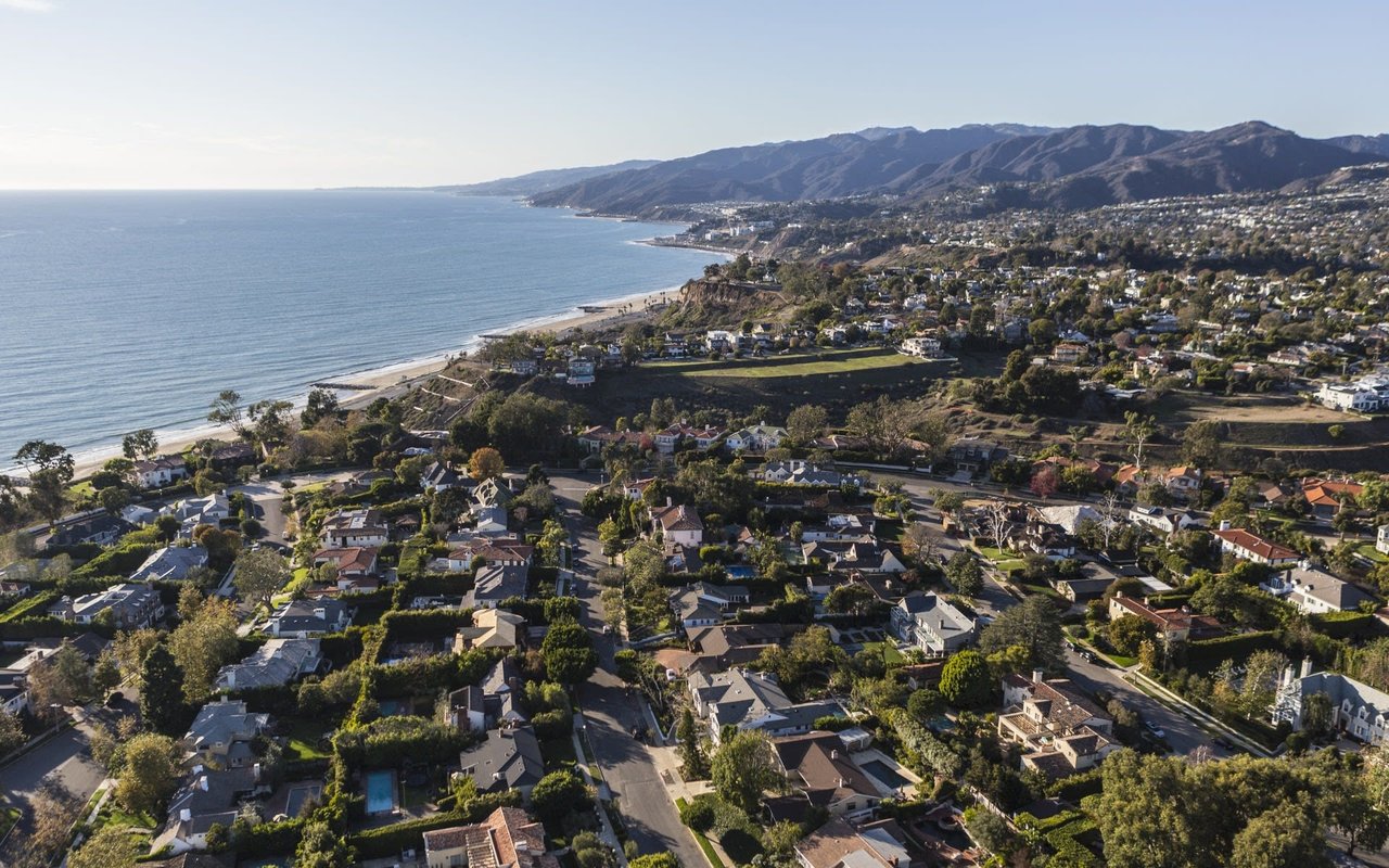
Brentwood real estate appeals to buyers who want a settled, tree-lined Westside neighborhood with canyon privacy and the Getty Center nearby. Brentwood is part of the City of Los Angeles, sits at the base of the Santa Monica Mountains and uses ZIP code 90049. Set-back homes on large lots define the flats south of Sunset Boulevard, while the canyons to the north feel more private and estate-like. The shops and restaurants of San Vicente Boulevard are the everyday draw.
This guide answers the questions that most often bring people to the page, from where Brentwood sits and what its ZIP code is to which restaurants are actually open in 2026. It reflects the January 2025 Palisades Fire, changes along San Vicente Boulevard and the Getty Center's planned closure.
Section | Takeaway |
|---|---|
Location and ZIP code | A City of Los Angeles neighborhood, ZIP 90049, between the 405 and the Santa Monica city line |
Homes and architecture | Estates in Brentwood Park, mid-century homes in Crestwood Hills, and canyon properties north of Sunset |
Landmarks, history and residents | Rancho roots, a 1948 Country Mart, and a Marilyn Monroe home that is now a city monument |
Schools | Two LAUSD elementary options, a large public middle school, and several private campuses |
Parks and outdoors | Santa Monica Mountains trails, the Getty Center, the Skirball Cultural Center and a private golf club |
Dining and shopping | San Vicente Boulevard and the Country Mart, with several 2025 closures and 2026 openings |
Getting around and safety | Car-oriented, anchored by the 405, with an active homeowners association |
What changed recently | Fire recovery, ailing coral trees and the Getty's 2027 closure |
Market | A thin, high-end market where a few sales can move published averages |
Brentwood is a neighborhood within the City of Los Angeles. It is not part of Beverly Hills, which is a separate city to the east beyond Bel Air, Holmby Hills and Westwood, and it is not part of Hollywood. The neighborhood sits on the Westside, with Santa Monica along its southwestern edge.
Commonly cited boundaries run as follows:
Sunset Boulevard divides the area. North of it the terrain rises into ridges and canyons, and south of it the neighborhood is mostly flat.
Detail | Brentwood, Los Angeles |
|---|---|
ZIP code | 90049 |
Area codes | 310 and 424 |
Jurisdiction | City of Los Angeles (not unincorporated county land) |
Population | About 32,000 residents, per Census Bureau survey estimates |
Police | West Los Angeles Community Police Station |
Fire | LAFD Station 19 |
Local Tip: Brentwood, California (ZIP 94513) is a different city in Contra Costa County, far from Los Angeles. Searches for "Brentwood CA" often surface both, so buyers should confirm the 90049 ZIP code or a Los Angeles address.
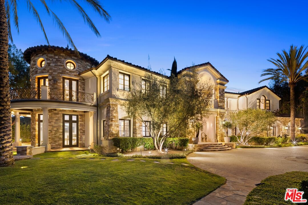
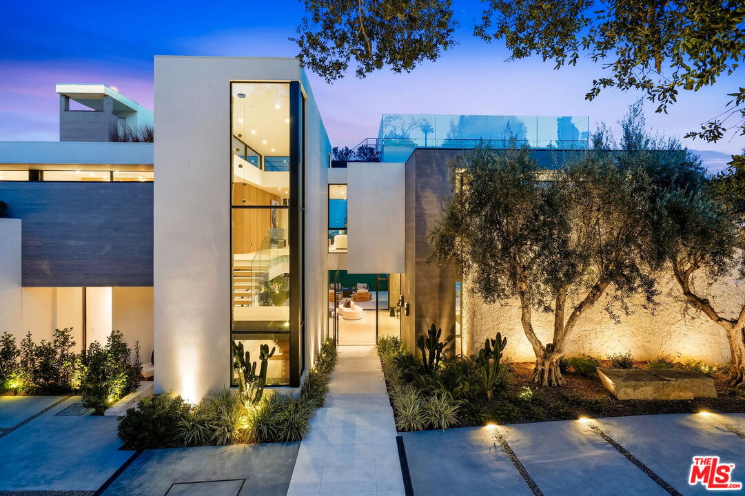
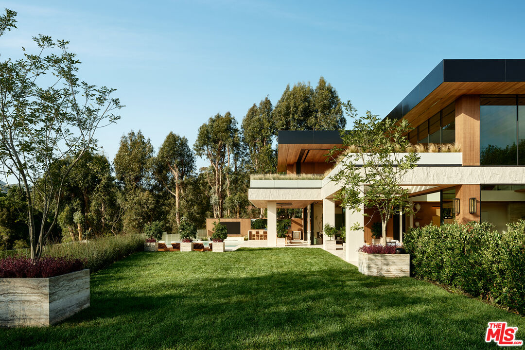
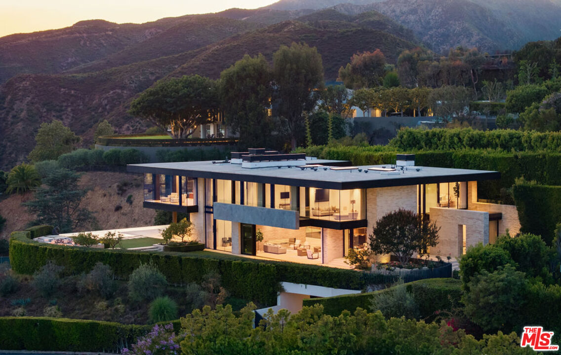
Single-family homes dominate, and many sit behind hedges or deep setbacks. Styles seen across the neighborhood include Ranch, Regency Revival, Spanish Colonial Revival, Tudor, Georgian and Mid-Century Modern, a range that Josh also describes in his post on what today's luxury buyers expect in a Brentwood listing. One recent example of the top of the market is 12846 Highwood Street in Brentwood Park, a 2023-built estate on a half-acre lot that Josh sold on September 1, 2026.
Brentwood is easier to understand as a set of districts, each with its own housing character:
Main Takeaway: Lot size, hillside conditions and privacy vary a great deal from one Brentwood district to the next, so two homes with the same address style can behave very differently in the market.
Buyers comparing districts can browse homes for sale in Brentwood and nearby to see how lot size, views and privacy line up in current listings and how they differ from one district to the next.
Those weighing other Westside estate areas may also want to read about the neighborhood of Bel Air, which sits just across the 405 and shares some of the canyon character found in Brentwood's northern hillsides.
Brentwood began as part of Rancho San Vicente y Santa Monica, a roughly 33,000-acre land grant. Development picked up after the 1880s, when a veterans' home opened nearby and a settlement called Westgate formed outside its gate.
Date | Milestone |
|---|---|
1880s | Veterans' home opens; Westgate settlement forms |
1910s | Westgate annexed by the City of Los Angeles |
1947 | Crestwood Hills mid-century community founded |
1948 | Brentwood Country Mart opens at 225 26th Street |
1961 | A November wildfire destroys hundreds of homes across Bel Air and Brentwood |
1976 | San Vicente's coral trees named a Historic-Cultural Monument |
1999 | Archer School for Girls buys the former Eastern Star Home on Sunset |
2024 | Marilyn Monroe's last home designated a city monument |
Residents with verified Brentwood ties include Marilyn Monroe, who bought her home on Fifth Helena Drive in February 1962 and died there that August, and the writers Joan Didion and John Gregory Dunne, who lived in the neighborhood until 1988. Arnold Schwarzenegger and Maria Shriver also raised their family in a Brentwood home.
Public students are served by LAUSD, and the neighborhood also has a deep private-school bench. High school boundaries split, so families should confirm the assigned school for a specific address.
School | Type | Grades | Address |
|---|---|---|---|
Kenter Canyon Elementary Charter | Public | K to 5 | 645 N Kenter Ave |
Brentwood Science Magnet | Public | K to 5 | 740 Gretna Green Way |
Paul Revere Charter Middle | Public | 6 to 8 | 1450 Allenford Ave |
Brentwood School (West Campus) | Private | K to 5 | 12001 Sunset Blvd |
Brentwood School (East Campus) | Private | 6 to 12 | 100 S Barrington Pl |
Archer School for Girls | Private | 6 to 12 | 11725 Sunset Blvd |
St. Martin of Tours School | Private | K to 8 | 11955 Sunset Blvd |
Mirman School | Private | K to 8 | 16180 Mulholland Dr |
Berkeley Hall School | Private | Preschool to 8 | 16000 Mulholland Dr |
Public high school attendance areas include University High School Charter in West Los Angeles and Palisades Charter High School, which serves parts of Brentwood including Brentwood Circle. Palisades Charter returned to its main campus on January 27, 2026, after the Palisades Fire damaged a large share of it.
The Santa Monica Mountains begin at the neighborhood's northern edge. Westridge-Canyonback Wilderness Park, about 1,500 acres, reopened on June 16, 2025, and its fire road links to upper Mandeville Canyon and Sullivan Canyon. The Sullivan Canyon trail starts on Queensferry Road and is a long out-and-back walk.
Nearby Will Rogers State Historic Park, technically in Pacific Palisades, reopened on November 8, 2025 with limited access. The fire destroyed the historic ranch house, but the polo field and about half of the trails were open at reopening.
Cultural stops are close by:
San Vicente Boulevard has been a shopping district since the late 1940s, and the center of gravity is still the Brentwood Country Mart, a barn-style village that opened on November 18, 1948 and still has its original post office, a shoe repair shop and a barbershop.
The restaurant scene turns over quickly. These places were confirmed open or taking reservations as of this refresh:
Several names that older guides still list are gone. A.O.C. Brentwood closed on August 1, 2025, and Pizzicotto also shut. Josh's own post on San Vicente Boulevard's recent changes tracks the new tenants. The Brentwood Farmers' Market meets on Sundays on Gretna Green Way, and the Country Mart runs family programming through the summer.
Local Tip: Restaurant hours and tenants change often here. A quick call or reservation check before a special dinner is worthwhile, and a planned h.wood Group lounge at 11920 San Vicente is expected in early 2027.
Brentwood is car-oriented. The 405 forms the eastern edge, and Sunset and San Vicente carry most local traffic. Caltrans repaving in the Sepulveda Pass has brought weekend lane reductions this fall, and the Brentwood Homeowners Association has pressed for limits on ramp closures. Metro's D Line Extension has opened its first section, but the Westwood and VA Hospital stations near Brentwood's edge are still under construction with no opening date listed.
On safety, the homeowners association reported in 2026 that overall crime fell in 2025, with vehicle break-ins and vehicle theft among the leading categories. Local services include LAPD's West Los Angeles station and LAFD Station 19, and the association's FireSafe Brentwood program offers home-hardening guidance. Cal Fire classifies the area from Mulholland down to Sunset as a Very High Fire Hazard Severity Zone, so hillside buyers typically ask about insurance and evacuation routes early.
The Palisades Fire of January 2025 prompted evacuations in Brentwood's hillside areas and burned at least one home in Mandeville Canyon. The larger story since then is recovery next door, where rebuilding in Pacific Palisades has brought construction traffic that local groups have tried to manage. Readers curious about that neighbor can see Josh's guide to living in Pacific Palisades.
Two other items matter to residents:
Brentwood is a thin, high-end market, so a handful of closings can swing any published average, and different data sources often disagree. Buyers are selective, take their time and negotiate, and they respond to homes that feel finished and architecturally coherent. Josh covers what that means for sellers in his post on what luxury buyers expect in a Brentwood listing, and his general advice on how to buy a luxury home applies here as well.
Sellers can start with the seller consultation page to talk through timing and preparation. Buyers often compare Brentwood with Pacific Palisades to the west and Santa Monica along its southwestern edge, and each has its own pace, housing stock and daily routine.
Whether someone is weighing a first look at the neighborhood or planning a sale, Josh Flagg is glad to talk through Brentwood's districts, the questions that come with hillside and flat-lot homes, and what the next few months might look like. There is no pressure to have a plan before reaching out, and a conversation can begin whenever it suits.
33,315 people live in Brentwood, where the median age is 42 and the average individual income is $136,049. Data provided by the U.S. Census Bureau.
Total Population
Median Age
Population Density Population Density This is the number of people per square mile in a neighborhood.
Average individual Income
There's plenty to do around Brentwood, including shopping, dining, nightlife, parks, and more. Data provided by Walk Score and Yelp.
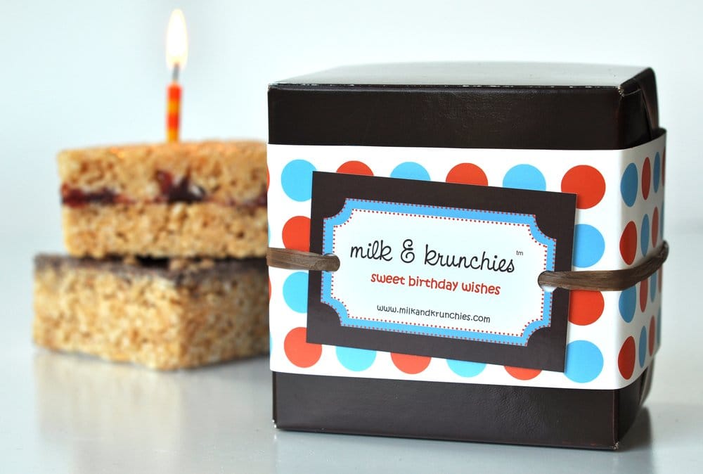
Explore popular things to do in the area, including Milk & Krunchies, Progenesis, and Personal Shopper and Wardrobe Stylist.
| Name | Category | Distance | Reviews |
Ratings by
Yelp
|
|---|---|---|---|---|
| Dining · $$$ | 0.53 miles | 4 reviews | 3/5 stars | |
| Dining | 1.29 miles | 0 reviews | 0/5 stars | |
| Shopping | 2.18 miles | 0 reviews | 0/5 stars | |
| Shopping | 2.21 miles | 0 reviews | 0/5 stars | |
| Shopping | 2.21 miles | 0 reviews | 0/5 stars | |
| Shopping | 2.22 miles | 1 review | 5/5 stars | |
| Shopping | 2.87 miles | 6 reviews | 4.3/5 stars | |
| Active | 0.53 miles | 5 reviews | 5/5 stars | |
| Active | 0.53 miles | 1 review | 5/5 stars | |
| Active | 0.53 miles | 1 review | 5/5 stars | |
| Active | 2.87 miles | 0 reviews | 0/5 stars | |
| Beauty | 0.37 miles | 0 reviews | 0/5 stars | |
| Beauty | 2.2 miles | 6 reviews | 4.3/5 stars | |
| Beauty | 2.82 miles | 1 review | 5/5 stars | |
| Beauty | 2.86 miles | 4 reviews | 5/5 stars | |
|
|
||||
|
|
||||
|
|
||||
|
|
||||
|
|
||||
|
|
Brentwood has 15,170 households, with an average household size of 2. Data provided by the U.S. Census Bureau. Here’s what the people living in Brentwood do for work — and how long it takes them to get there. Data provided by the U.S. Census Bureau. 33,315 people call Brentwood home. The population density is 13,603 and the largest age group is Data provided by the U.S. Census Bureau.
Total Population
Population Density Population Density This is the number of people per square mile in a neighborhood.
Median Age
Men vs Women
Population by Age Group
0-9 Years
10-17 Years
18-24 Years
25-64 Years
65-74 Years
75+ Years
Education Level
Total Households
Average Household Size
Average individual Income
Households with Children
With Children:
Without Children:
Marital Status
Blue vs White Collar Workers
Blue Collar:
White Collar:

Josh Flagg is one of the world's most successful real estate agents and has helped hundreds of buyers find their dream home in Los Angeles and Beverly Hills, resulting in over $3 Billion of closed real estate transactions.
Search by Cities Search by Zip Codes